Interview – How gas flux analyses can reduce geothermal discovery risk
 Interview - How gas flux analyses can reduce geothermal discovery risks


In this interview with Dr. Egbert Jolie of fluxtec, we discuss the value of soil gas flux measurements as an added surface exploration tool for geothermal.
Resource characterization remains one of the most effective methods for mitigating the discovery risks of geothermal projects. Several tools and techniques are already in practice for this, but the risk can never be reduced to nil until the drilling campaign has started.
The main reason is that each exploration technology can provide very specific information on certain reservoir properties, but not a comprehensive picture. Thus, the general rule is – the more (good quality and relevant) data, the better.
In this interview with Dr. Egbert Jolie of the startup fluxtec, we take a detailed look at high-resolution gas emission mapping. This is another tool that can be used to identify and characterize potential geothermal resources. How exactly does this work and how can we use it to mitigate the risks of geothermal development?
Can you briefly introduce to us the services that fluxtec is offering the geothermal industry?
fluxtec is a professional service provider of gas analyses (e.g. for carbon dioxide, methane or radon), relevant for a wide range of applications in exploration and monitoring. Our key motivation is:
- to reduce the risks associated with the development of georesources, and
- to improve the understanding of subsurface processes at relevant time scales.
We have many years of R&D experience in geothermal projects, but our methods are also useful in other areas. These include mining, borehole integrity, environmental studies, landfill monitoring, safe operation of underground gas storage facilities, or risk monitoring of potential geohazards.
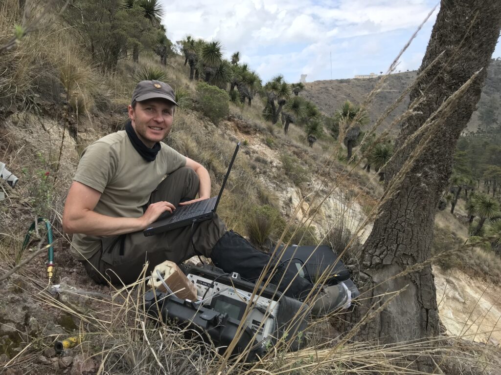
For the most realistic assessment of geothermal reservoirs, project developers rely on high-quality data obtained using the most advanced exploration methods. To this end, fluxtec offers customized, affordable, and multi-scale solutions ranging from single point to reservoir-scale studies. We use state-of-the-art technologies and innovative workflows for data acquisition, processing, and visualization. A variety of gas analyzers is available for measurements i) at shallow depths (<1m), ii) at the interface between geosphere and atmosphere, and iii) above the ground (~1m).
As a surface exploration tool, how can gas flux measurements help with the development of geothermal projects?
Gases are released into the atmosphere from deep sources over large areas. This can often happen without any obvious geothermal surface manifestations such as hot springs, steam vents, or fumaroles and at very low emission rates. However, even the smallest quantities of gas emissions at the Earth’s surface can serve as fingerprints of processes in the deep or shallow underground.
Gas measurements are one of the few methods that can actually provide evidence of active fluid circulation in reservoirs. The results can also help to estimate the dimension of reservoirs and locate deep geothermal upflows along permeable fracture zones, which are considered as promising targets for geothermal drilling. Gas analyses add value to integrated exploration approaches and help to reduce uncertainties in the exploration phase.
Gas emissions are not only characteristic of a variety of natural systems (e.g. geothermal resources, volcanoes, tectonic rifts), but can also occur as consequence of human activities and installations (e.g. boreholes, mining, landfills, gas storages). In this context, we are also able to carry out time-lapse surveys or continuous analyses for monitoring.
Can you tell us briefly about studies that link gas flux anomalies with good geothermal drilling targets or production zones?
Our expertise is based on strong international R&D partnerships. We have carried out projects in Iceland, the Czech Republic, Ethiopia, Rwanda, Tanzania, New Zealand, the USA, Mexico, and Germany. A very interesting case study was conducted at the Aluto Langano geothermal site in the Main Ethiopian Rift, and I would like to briefly introduce you to this work.
The objective of this study was to develop geothermal exploration concepts for areas with little or no hydrothermal surface expressions suitable for fluid sampling and analyses. In such areas, soil gas surveys can add value to established exploration technologies.
We report carbon dioxide, radon, and thoron emission data as well as ground temperatures from the Aluto volcanic complex. Gas emissions were systematically analyzed by using an extensive measurement network with predefined measurement locations in the order of 2,000 points across the geothermal reservoir. Based on preliminary results, the survey was extended by isotopic analyses at selected sites. With this suite of gas emission measurements, we were able to identify major, deep-rooted and permeable structures with active fluid circulation and to define target areas for new geothermal production wells.
We show that differences in gas signatures (i.e. emission rates and spatial pattern of emissions) can be used to identify predominantly volcanically and/or tectonically influenced compartments. Major gas emissions indicate significant fluid circulation at depth, which is typical for magmatic systems. Such high gas emissions have been observed in areas affected by major tectonic structures interacting with magmatic bodies at depth. Both permeability and heat are present in these tectono-volcanic zones.
Predominantly fault-controlled sectors also show hydrothermal fluid circulation, but to a lower extent compared to tectono-volcanic sectors. Minor variations in gas emissions in the central part of the volcanic complex indicated previously unknown permeable structures. Within the Aluto volcanic complex, existing geothermal production wells mainly target fault-controlled domains. However, the results of the study indicate strongest fluid circulation in areas where tectonic and volcanic elements intersect.
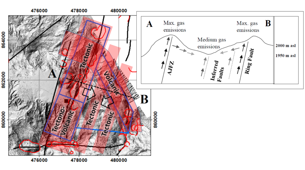
The results of the soil gas survey improved our understanding of the interaction between tectonic and volcanic controls on the existing geothermal system. This information provided a solid basis for recommendations on the future exploration and economic development strategy for the site.
What factors should we consider when measuring gas flux for geothermal surveys? How sensitive is this method to fluctuations in temperature, humidity, or soil moisture?
There are several things to consider when working with gas emissions. Each of the parameters you mentioned can affect the results to some degree. Additionally, there can be seasonal and even daily effects. In this context, we have to differentiate between exploration and monitoring.
For exploration, our main interest is a snapshot of the gas emission pattern in a target area. Thus, we focus on spatial rather than temporal variations in gas flow. Here, information on air temperature and barometric pressure variations is relevant for data processing.
For long-term monitoring, additional data is required to distinguish between temporal variations in gas emissions due to changes in the reservoir or atmospheric effects. Relevant data are usually collected with on-site weather stations (e.g. precipitation, air temperature, barometric pressure, wind speed, and direction) and soil sensors (soil moisture, ground temperature).
How does a soil gas flux survey compare to other surface survey methods in terms of time, cost, and logistical complexity?
At this point I would like to highlight some of the key advantages of high-resolution gas emission mapping. All technologies we are using are non-invasive, thus environmentally friendly. We use portable equipment that enables us to operate completely independently and without the need for logistical support, even in difficult terrain. This may be densely vegetated areas or mountainous terrain to which other technologies may have only limited access.
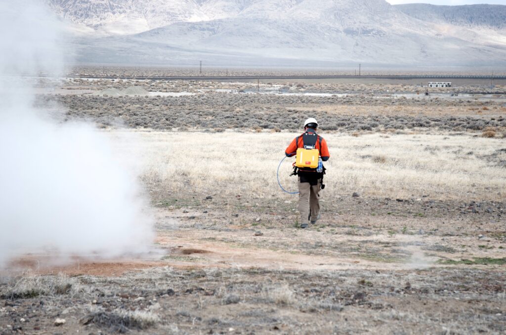
Data collection is extremely time-efficient, and advanced workflows result in survey costs below those of conventional exploration technologies. An average survey will last only 5-10 days and covers multiple square kilometers. For almost all measurements we get real-time data on site, which enables us to adjust survey design during field campaigns and focus on the most prominent target areas.
What do you think is exciting about the geothermal industry nowadays?
Geothermal energy has been my passion for more than 20 years. This started when I travelled to Ethiopia for the first time as a student and later on when I moved to Iceland for my studies. From the very beginning, I appreciated the well-connected international geothermal community of academic and industry partners, all pursuing the same goal of advancing geothermal energy as a renewable energy source. It is a truly special spirit that I have always felt.
I also like the enthusiasm of initiatives like Project InnerSpace. These people are creating an awareness of the resources beneath our feet. I am sure there are still many exciting things ahead of us.
Where do you see geothermal going in the next 10 years?
Geothermal resources offer more opportunities than just power generation. There is a huge demand for heat, including process heat for the industry, but of course also for heating purposes. So, not only do I hope that more countries join the 1 GWe club in the next 10 years, but also that there will be a similar club for countries with direct use applications.
The use of geothermal energy can make an important contribution to achieving our Sustainable Development Goals. There are still many exciting things ahead of us. Just think of the extraction of raw materials from geothermal brines. I am convinced that such co-creation initiatives will be considered even more often in the future.
What would you say is the biggest challenge of being a startup in the geothermal space?
Companies and their employees need to get to know you and understand what you have to offer. Like many start-ups, I spend my time explaining the value of gas analytics and why exploration of georesources can only be successful on the basis of integrated and interdisciplinary exploration concepts. Gas analytics is a powerful key technology for geothermal energy projects and beyond. I see so many possible applications and would like others to see it the same way. Monitoring the integrity of boreholes and underground gas storage facilities is certainly an important overarching field of application for this technology.
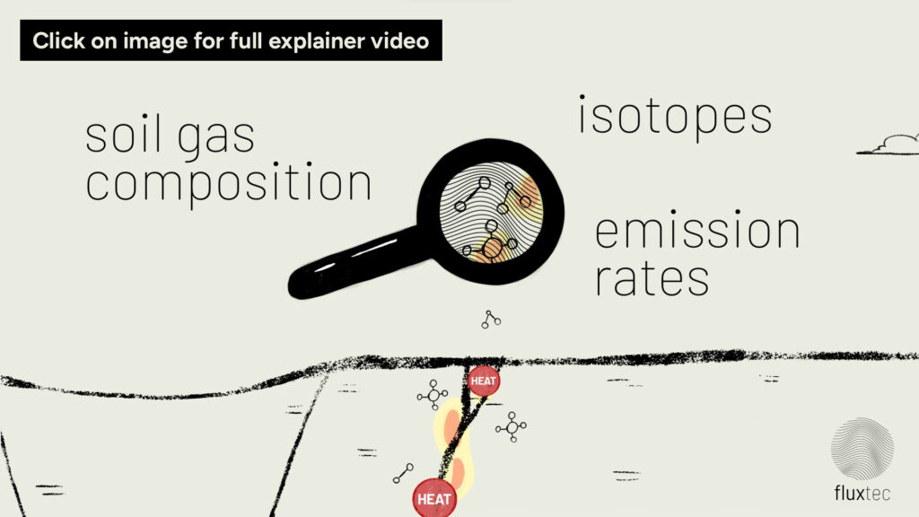
Learn more about fluxtec and soil gas flux measurements at the company’s official website. Curious about how soil gas flux works? Check out the short explainer video below from fluxtec.


