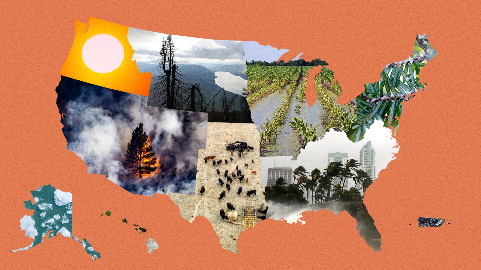
Every four years, the federal government is required to gather up the leading research on how climate change is affecting Americans, boil it all down, and then publish a National Climate Assessment. This report, a collaboration between more than a dozen federal agencies and a wide array of academic researchers, takes stock of just how severe global warming has become and meticulously breaks down its effects by geography — 10 distinct regions in total, encompassing all of the country’s states and territories.
The last report, which the Trump administration tried to bury when it came out in 2018, was the most dire since the first assessment was published in 2000. Until now.
The Fifth National Climate Assessment, released on Tuesday by the Biden administration, is unique for its focus on the present. Like previous versions, it looks at how rising temperatures will change the United States in decades to come, but it also makes clear that the rising seas, major hurricanes, and other disastrous consequences of climate change predicted in prior reports have begun to arrive. The effects are felt in every region. In the 1980s, the country saw a billion-dollar disaster every four months on average. Now, there’s one billion-dollar disaster every three weeks, according to the assessment. All of the many extreme weather events that hit the U.S., from the tiniest flood to the biggest hurricane, cost around $150 billion every year — and that’s likely a huge underestimate.
“Climate change is here,” said Arati Prabhakar, director of the White House Office of Science and Technology Policy in the Biden administration during a briefing on the report. “Whether it’s wildfires or floods or drought, whether it’s extreme heat or storms, we know that climate change has made its way into our lives and it’s unfolding as predicted.”
The report outlines steps every level of government can take to combat the climate crisis. And it takes stock of progress that has been made over the past four years. There’s good news on that front: President Joe Biden and Democrats in Congress have managed to pass historic climate measures that are expected to reduce the country’s carbon footprint between 32 and 51 percent by 2035, putting the U.S. closer to meeting its emissions targets under the global climate treaty known as the Paris Agreement. A number of cities and states have passed climate policies that can serve as a blueprint for what actions the rest of the country, and indeed the world at large, needs to take in the coming years. California’s clean car program and the Northeast’s regional carbon cap-and-trade program are two examples.
Despite this progress, climate impacts — oppressive heat domes in the Southeast that linger for weeks on end, record-breaking drought in the Southwest, bigger and more damaging hurricanes in the Atlantic basin, wildfires of unusual duration and intensity along the West Coast — are accelerating. That’s the nature of human-caused climate change: The consequences of a century and a half of burning fossil fuels are arriving now. Even if we stopped burning oil and gas tomorrow, some degree of planetary warming is baked in.
This reality, the report says, leaves the country no choice but to adapt, and quickly. “We need to be moving much faster,” the Biden administration said. “We need more transformative adaptation actions to keep pace with climate change.”
The Grist staff, located all over the country, reviewed the assessment to provide you with the most important takeaways for your region. Here they are.

Alaska
One of the joys of living in Alaska is being able to walk through thick brush without fearing that a tiny, eight-legged critter could latch onto you at any moment and give you a debilitating illness like Lyme disease (though, sure, grizzly bears are a worry). According to the assessment, that’s about to change: The western black-legged tick is creeping north, and it’s poised to establish a new home in the country’s largest state.
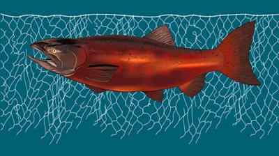
As Alaska warms two or three times faster than the rest of the world, it’s making life harder for many of the 730,000 people who live there, particularly Indigenous and rural residents who rely on hunting and fishing for food. Crabs are sweltering in the Bering Sea. Salmon are disappearing, leaving fish racks and freezers empty in Yup’ik and Athabascan villages along the Yukon River. Melting sea ice, extreme ocean warming, and toxic algae blooms are unraveling food webs, killing seabirds and marine mammals. It’s not pretty.
And it’s not all happening at sea. The ground beneath Alaskans’ feet is collapsing. Eighty percent of the state sits on permafrost, much of which is thawing. In Denali National Park, a melting underground glacier triggered a landslide in 2021 that forced the park’s main road to close for a few years. Add freak storms, flooding, and erosion to the mix, and Alaska Native communities face nearly $5 billion in infrastructure damage over the next 50 years, the report says.
There are a few bright spots. Higher elevations could see more snow, not less, and Alaska’s growing season is getting longer — a boon for a fledgling agricultural industry. Still, if you migrate north to start a farm, don’t think you’ll have found a refuge from wildfires, even in the Arctic. Just Google “zombie fires.”
– Max Graham

Hawaiʻi and the Pacific Islands
Hawaiʻi, Guam, American Sāmoa, the Northern Mariana Islands, the Republic of Palau, the Federated States of Micronesia, the Republic of the Marshall Islands
Every month on the sixth day after a new moon, generations of Palauans have ventured out under the hot late-afternoon sun to toss their nets into seagrass meadows to capture rabbit fish.
In 2021, the low tide didn’t come. Neither did the fish. The Indigenous fishers in Palau were left waiting, wondering if the higher tide would ever ebb.
It’s not yet clear whether climate change is to blame. But what is clear from the climate assessment is that rising sea levels, worsening storms, and other climate-related effects will transform the lives of nearly 1.9 million people who live in the states, nations, and territories that make up the U.S.-affiliated Pacific islands, many of them Indigenous peoples who have contributed little to climate change yet are bearing the worst of its impacts.
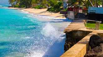
Low-lying atolls in the Marshall Islands are already disappearing. The islands that remain risk losing their drinking water as saltwater intrudes on thin freshwater aquifers. In American Samoa, tuna canneries could see as much as a 40 percent drop in their catch by 2050 compared with the 2000s, according to the report, if carbon emissions don’t fall fast enough.
In Hawaiʻi, a 3.2-foot rise in sea level could displace 20,000 people and cost $19 billion. That same scenario would affect 58 percent of the built environment on the island of Guam.
Maui residents still reeling from the horror of August’s wildfires can expect more drought on the leeward coast that could provide tinder for more flames. Already, fires burn a greater proportion of land area in U.S.-affiliated Pacific islands than on the continental U.S.
Health care, already a longstanding challenge in the islands, is expected to get worse, as temperatures rise and mosquito-borne diseases like dengue and Zika proliferate. One study found 82 percent of heat deaths in Honolulu can already be attributed to climate change.
— Anita Hofschneider

Midwest
Illinois, Indiana, Iowa, Michigan, Minnesota, Missouri, Ohio, Wisconsin
If you’ve ever driven through Iowa, Illinois, or Indiana, you won’t be surprised to learn that the region produces almost a third of the world’s corn and soybeans. In fact, there are so many crops getting irrigated, water is evaporating off them and cooling summer days in parts of the Midwest, like central Wisconsin, countering some of the warming from climate change. But rapid swings between flooding and drought, along with the spread of corn earworms, Japanese beetles, and other pests, are hurting these staple crops and the farmers who grow them. Climate change, the report says, has also led to smaller harvests of wild rice, a staple that’s central to the identity of the Indigenous Anishinaabe.
The region is getting more rain, and that’s promising for wheat production, but bad news for aging dams, roads, bridges, and wastewater facilities, which are already getting overwhelmed by water. The amount of precipitation during the 1 percent of rainiest days in the Midwest has increased by 45 percent since 1958, the report says.
The Great Lakes, the crown jewels of the Midwest, are among the fastest-warming lakes in the world, with climate change stressing out an ecosystem already plagued by toxic algae and invasive species and also reducing populations of walleye and trout. Warmer winters mean there’s less ice atop lakes and ponds, threatening traditions like ice fishing from Minnesota to Michigan.
Those less-harsh winters are also expanding the ranges of disease-carrying ticks and mosquitoes. Lyme disease has exploded in the Midwest to the point that it’s now endemic, and by 2050, the Ohio Valley may see more than 200 cases of West Nile virus every year. Another once-rare phenomenon that’ll become more common: wildfire smoke. Midwesterners got a preview this summer when smoke poured in from the fires in Canada, inundating Illinois, Michigan, and Ohio with “very unhealthy” air.
— Kate Yoder

Northeast
Connecticut, Delaware, Maine, Maryland, Massachusetts, New Hampshire, New Jersey, New York, Pennsylvania, Rhode Island, Vermont, Washington, D.C., West Virginia
When it comes to climate-fueled flooding, the 67 million residents of the U.S. Northeast are especially at risk, and the region’s aging stormwater and sewage infrastructure only makes matters worse. This summer, historic flooding in New York, Vermont, and Massachusetts killed multiple people and caused hundreds of millions of dollars in damage, a preview of flooding-related dangers to come. Extreme precipitation events have increased 60 percent across the entire region, which the report says could be due to a combination of more tropical storms and a warmer, wetter atmosphere. No other region in the U.S. has seen such a marked increase in rainfall.
But climate impacts within the Northeast extend far beyond flooding. Days when real-feel temperatures are over 100 degrees Fahrenheit will triple by 2050 under an intermediate warming scenario, the report said, and communities that lack access to reliable and affordable air conditioning will see their health and general well-being decline as a result.
The report also warns that states along the coast will have to confront the effects of warming water on marine species, fish stocks, and tourism — if they aren’t doing so already. In the Gulf of Maine, for example, lobster, oysters, and other shellfish are expected to decline. Animals that can migrate, such as right whales, will abandon the gulf for cooler waters north of the state. Sea bass, some types of squid, and other temperate marine species, on the other hand, will flourish. Warming winter nights are allowing damaging forest pests, such as the emerald ash borer and the woolly adelgid, to extend their ranges into colder latitudes and plague new ecosystems.
Rising seas along the coastline will push homes and infrastructure inland, raising the controversial question of who gets to leave and who can stay. Already, home buyout programs and multibillion-dollar flood protection initiatives are underway in New Jersey and New York.
— Zoya Teirstein

Northern Great Plains
Montana, Nebraska, North Dakota, South Dakota, Wyoming
In parts of the country like southwestern Nebraska, it’s not uncommon for baseball-sized hail to fall from the sky during thunderstorms in the summer months. Unfortunately for people in the northern Great Plains, it’s likely to get worse: The region will experience the largest increase in hail risk, according to the report, along with more storms. By 2071, days with hail of two inches in diameter or more could increase threefold and cover almost nine times more ground. Hail that size can smash windows, dent cars, and cause severe injuries.
The report highlights a shift in the region’s water, so vital for the landlocked landscape spanning Montana, Wyoming, Nebraska, and the Dakotas. Decreasing snowpack could cut short winter tourism seasons and reduce available surface water, putting more stress on limited groundwater. At the same time, more flooding and extreme weather could hit communities with the fewest resources to respond. Two storms in 2018 destroyed nearly 600 homes on the Pine Ridge Indian Reservation, with half not repaired a year later.
Hotter temperatures have already limited harvests of traditional foods and medicine used by many indigenous nations. That includes wild turnips and chokecherries, culturally significant plants for the Lakota people. Rising temperatures have also dried the soil, raising wildfire risks. In the Great Plains grasslands, the number of wildfires has already more than doubled since 1985. Forest fires in Montana and Wyoming have shot up almost ninefold since the 1970s. All these trends are likely to get worse.
But these problems might not be enough to scare off newcomers trying to get away from droughts and wildfires elsewhere in the country. The report suggests that fewer cold snaps and a longer growing season in the Great Plains could lure people migrating from other regions in search of a new place to live.
— Akielly Hu

Northwest
Idaho, Oregon, Washington
Climate change might be putting an end to “Juneuary,” the term for the Northwest’s chilly early summers. Take the infamous “heat dome” that smothered Washington and Oregon in late June 2021. The searing heat melted electrical equipment in Portland, buckled roads outside Seattle, and led to nearly a thousand deaths in the two states (and British Columbia). Without climate change, a heat wave that intense would’ve been “virtually impossible,” according to one study cited.
The report says the Northwest can expect hotter heat waves — and more deaths. Heat and wildfire smoke in the region have already led to thousands of deaths since 2018, when the last National Climate Assessment was published. Extreme heat is worse in formerly redlined neighborhoods like the Albina neighborhood in Portland, where temperatures can reach 13 degrees Fahrenheit hotter than the rest of the city.
Most of the region’s drinking water has come from melting snow, stored in mountain ranges like the Cascades that run through Washington and Oregon, or the Sawtooth range in Idaho. But warmer winters are turning more snowstorms into rainstorms, leading to destructive floods in the winter and dry rivers in the summer. Glaciers are melting, even atop iconic Mount Rainier.
On the coast, rising waters pose problems. The town of Taholah on the Quinault Reservation along Washington’s northwest coast could see the ocean climb as much as 1.2 feet by 2050. The Quinault Indian Nation recently started to move many of its homes and government buildings farther inland. The report warns that the cost and complexity of managed retreat might make it difficult for other coastal communities.
Diminishing streams could be troublesome for numerous hydroelectric dams. Local and state governments might need to find new sources of energy to power the region’s electric cars and brand-new air conditioners — without relying on the fossil fuels that got us into this mess.
—Jesse Nichols

Southeast
Alabama, Arkansas, Florida, Georgia, Kentucky, Louisiana, Mississippi, North Carolina, South Carolina, Tennessee, Virginia
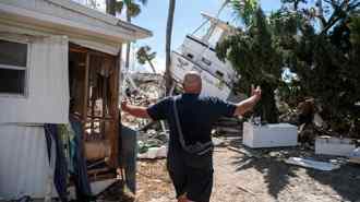
The sunny and fast-growing Southeast is on a collision course with climate change. Its cities have gobbled up more than 1.3 million acres of exceptionally biodiverse land since 1985, and more than a million people have moved to Florida alone since 2018. These newcomers are sitting ducks for worsening disasters, especially floods. The Southeast has seen almost two dozen hurricanes make landfall since 2018, and these monster storms are ballooning to full strength much faster as they cross a hotter Gulf of Mexico. The slow creep of sea-level rise has also led to more frequent tidal flooding in coastal cities like Miami. That’s bad news for the millions of people who have bought waterfront homes over the past few decades.
To say the region is ill-prepared for this era of climate disaster would be an understatement. Many Southeastern cities are plagued with flimsy manufactured housing, antiquated drainage systems, and decades-old power grids. Heat stroke will become a bigger danger for outdoor workers, and more blackouts will knock out life-saving AC units in big cities. Louisiana saw more than 20 such events between 2011 and 2021. Warmer spring temperatures will also increase pollen counts in cities like Atlanta, worsening air quality. All these impacts will be more dangerous for the region’s Black residents, who live in hotter and more flood-prone places than their neighbors.
The region’s declining rural areas also face existential threats, as industries find themselves unprepared for a warmer world. Farmers of cash crops such as citrus and soybeans, for instance, are fighting a four-front war against drought, flooding, heat, and wildfires, which all reduce annual yields. Extreme weather will continue sapping these moribund economies, leading to more out-migration and urban growth.
— Jake Bittle

Southern Great Plains
Kansas, Oklahoma, Texas
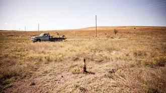
The southern Great Plains encompasses a stunning variety of terrain, from the windy plains of Kansas to the swamps of East Texas. In some parts of the region, annual precipitation is as low as 10 inches, and in other parts it’s as high as 50 inches. Accordingly, the impact of climate change looks very different depending on where you are. In the high plains of Oklahoma, drought has drained rivers and aquifers for rural communities, but residents of large Texas cities like Houston and Dallas have to worry about floods overwhelming asphalt streets and clogged storm drains.
Kansas and Oklahoma don’t face the risk of the billion-dollar disasters that plague Texas, but the report finds that earlier springs in those two landlocked states have “reduced plant growth and diminished productivity” for all-important wheat and sorghum crops. Lyme disease-bearing ticks have started to appear even in the depths of winter, when they’re supposed to be hibernating.
Energy is the backbone of the region’s economy, especially in Texas. This massive industry has helped accelerate climate change, and it’s also vulnerable to climate shifts: Hurricanes and increasingly large rain storms could knock out plants and refineries on the Gulf Coast. Agriculture and livestock, the other main industries, are also vulnerable to droughts: Dry spells in Kansas and Oklahoma have “increased labor demands for feeding, forcing producers to sell genetically valuable animals,” the report notes. These shifts could cost billions of dollars to the region’s economy.
The report also highlights threats to another mainstay of life in the South: football. Extreme heat and flooding could endanger athletes and force schools to postpone games. This already happened in 2021, when Hurricane Ida forced the Tulane University football team to play a game at the University of Oklahoma instead of at home in New Orleans.
— Jake Bittle

Southwest
Arizona, California, Colorado, Nevada, New Mexico, Utah
A succession of droughts, fires, and heat waves has thrown the Southwest’s economy into turmoil over the past decade, upending housing markets and stalwart industries like agriculture.
The most visible disaster in the region is wildfire. The already hot and dry Southwest is getting hotter and drier, which makes it easy for big fires to rage for weeks and even months, destroying thousands of homes. It also means that “fire season” now lasts roughly all year, as 2021’s Marshall Fire in Colorado demonstrated. The cost of putting out wildfires in California exceeded $2 billion that year, according to the report. As a result of all this damage, insurance costs are skyrocketing for everyone, even city dwellers who aren’t directly threatened by blazes.
On California’s coast, rising seas have eaten away at bluffs, causing stretches of road to collapse into the water. The authors of the report write that a rash of marine heat waves in the Pacific between 2013 and 2020 caused massive die-offs in the state’s salmon fishery and beached starving sea lions. Under the worst warming scenarios, the Pacific sardine fishery could migrate as much as 500 miles north.
In the desert, farms, ranches, and cities have drained reservoirs on big waterways like the Colorado River. Rural residents in California and Arizona are seeing their wells go dry during increasingly severe droughts, thanks in large part to thirsty nut and dairy farms that have sucked up groundwater. And drought has been even more challenging for the many Native American tribes. The Navajo Nation, for instance, lacks legal access to the Colorado River, so most residents haul their water by truck. Building new water infrastructure is more than 70 times as expensive on the reservation as it would be in the average U.S. town, according to the report
— Jake Bittle

U.S. Caribbean
Puerto Rico, U.S. Virgin Islands
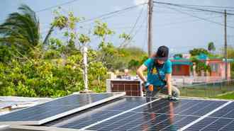
The climate impacts facing Puerto Rico and the U.S. Virgin Islands don’t differ wildly from those of the continental states: Storms will strengthen, coastlines will shrink, temperatures will rise, and rainfall will diminish.
What’s distinct about how the U.S. Caribbean territories will experience these hazards (apart from the islands’ location in a hurricane-prone ocean) are the economic and social conditions that have already made the region’s disasters more deadly — conditions that can be traced to the territories’ history as de facto U.S. colonies. More than 40 percent of Puerto Rico’s 3 million residents live below the poverty level, as do almost 20 percent of the 87,000 people living in the U.S. Virgin Islands.
After Hurricane Maria, which devastated Puerto Rico in 2017, mortality rates were higher for the elderly and those with the lowest household incomes. Studies found that nearly 3,000 excess deaths occurred after the storm because people lacked access to basic services.
That resource imbalance also shows itself in the dearth of necessary data available to assess current and future climate impacts in the region, especially in the U.S. Virgin Islands. The report is full of footnotes conceding that data was unavailable for the Caribbean territories.
Without improved social and economic resilience, U.S. Caribbean residents will continue to be uniquely vulnerable to storms, floods, and heat.
“We may be facing more extreme hurricanes, but if we have the capacity, the quality of life, the social conditions to be prepared, it wouldn’t be that catastrophic,” said Pablo Méndez-Lázaro, lead chapter author and associate professor of environmental health at the University of Puerto Rico. “If we keep having a huge amount of people living under the poverty level, with preexisting conditions, exposed to flood areas, we will face another María.”
— Gabriela Aoun Angueira

