
By Marla Keene, technology writer, AX Control
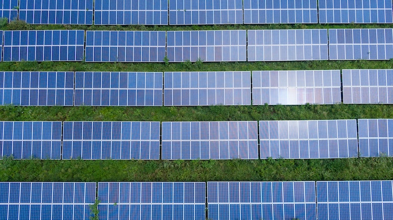
According to the U.S. Energy Information Administration, utility-scale solar PV capacity in the top three producing states has increased by 10.8 GW over the past three years alone. While this exponential growth is expected to continue, it comes with challenges that will need to be addressed, including how to inspect solar fields and maintain optimal output.
 Luckily, there are a number of technologies on the horizon that will aid in that challenge. And like the cost of PV equipment, the costs associated with these technologies are dropping with time. This includes increased use of drones, RGB imagery, artificial intelligence, as well as the incorporation of 5G networks as they become available across the country.
Drones
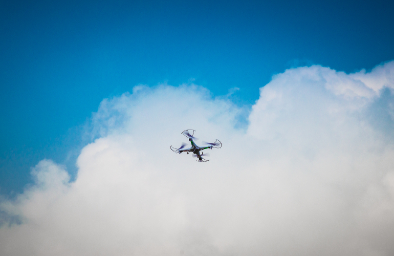
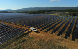
The use of drones for solar field inspection has been rapidly increasing over the last few years. Traditional assessments using field engineers and hand-held cameras is time-consuming and possibly hazardous work, and can lead to missed opportunities due to human error. Semi-autonomous drones can provide the same data while offering significant advantages over this older inspection method, including:
- An increase in efficiency. Drones can document anomalies over large areas with a single flight; for example, senseFly’s eBee X can map 161 acres in a single 42-meter flight. Vandalism, module failures and issues with cells and diodes can be identified in one flight on a geo-accurate digital model that engineers can then use to locate and correct problems.
- Improved data. Data collection is streamlined and connected to GPS or mapping software for accuracy. Because drones map entire sections at one time using GPS coordinates, gaps in data collection are limited or eliminated.
- Less hazardous. Faster inspections with fewer man-hours mean less exposure to the elements, to animals and to other potential dangers.
- Better reporting. Most drone applications will deliver drone data as punch lists, aerial inspections or field repair reports that can be delivered to smart phone apps or directly to on-site computers.
RGB Imagery
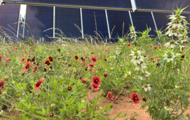
Early drone technology was manually controlled and may have been equipped with either a thermal camera or a visible light (RGB) lens. Now, both datasets can be used together. While thermal imaging can identify some issues like hot-spots caused by shading, soiling or failing bypass diodes, RGB or visible light data allows you to see exactly what is happening in your solar field at the time of the inspection. This can help identify issues beyond panel thermal problems, such as compromised points in your fencing perimeter or areas where erosion or vegetation may need to be addressed.
Artificial Intelligence
 When drone technology is combined with artificial intelligence, data can be manipulated in interesting ways. For example, AI can use the combination of RGB and thermal data from an inspection to match up scans and then computationally remove obstructions (such as overgrowths of vegetation) and review the surface underneath — like say, a panel edge. This type of optical sectioning may have further ramifications to inspection by offering a more complete view through vegetation to the ground below and between panel rows.
AI can also be used to forecast problems before they occur by using contextual information from your data. Take the example of erosion from before. AI algorithms can be trained to recognize the relative ground elevation and slope orientations around your solar field; when areas deviate from these norms, they can be flagged as premature erosion points, leading to action far sooner than would have otherwise been possible.
5G
As solar infrastructure expands, so too will the demand for preventive maintenance. The semi-autonomous use of drones may give way to preventive maintenance as a service model that will run drones in autonomous swarms offering up data at the edge of the communication network.
But this type of application will rely on low-delay data transmission capable only with 5G network architecture. Since these networks can be up to 100-times faster than 4G, they allow for continuous monitoring and offloading of data from hardware to the cloud, where it can be quickly accessed for analysis. With this infrastructure supporting connected drones, maintenance could become ongoing rather than sporadic, and could include:
- Regular surveys of infrastructure to ensure proper working order.
- Security oversight and boundary limit checks.
- Daily meteorological surveys.
- Forestry and vegetation growth datasets to predict management requirements.
Additionally, autonomous navigation requires a system that can sense its surroundings and respond in a quick and highly intelligent nature. 5G networks will be part of this capability by driving ultra-low latency between the drone and its positioning directives, allowing drones to make the jump from semi-autonomous to independent.
As technology continues to advance, more capabilities will be within the reach of most solar energy producers. Each new tool will have its own payoff. But how should you decide what to invest in, and when?
Start by asking the right questions. Where have you traditionally needed better inspection? How can technology potentially cut down on operating costs? What part of new technology adoption should be brought in-house, and what can be outsourced? What preliminary steps need to be taken now, and what needs to be implemented next year, or the year after? The answers to these questions will help guide the timing of your actions.
Technology writer Marla Keene works for AX Control, an industrial automation parts supplier located in North Carolina. She writes about AR/VR, drones, green tech, artificial intelligence and how technology is changing our world. Her articles have been featured in Power Magazine, Robotics Tomorrow and on other industry sites. Before working for AX Control, Marla spent 12 years running her own small business.
Why would an O&M company use dronesnif there’s SCADA already in place for monitoring a Solar Plant? Would drones peehaps make more sense economically when the Plant size is really large (because area is very large)?
I am a drone service provider. And have been doing PV inspections for several years. Drones are definitely the way to do solar farms. The fast and efficient and the reports at the end give all the details of what’s wrong and where it is. The Drone industry however is somewhat restricted by the FAA and the days of drones flying out autonomously to check Solar Panels are a ways away.
I just finished a 70 MW. It took me four and a half days because I had some issues with clouds and irradiance levels were low. Ideal reporting happens when your radiance is above 500 W/m2.
I couldn’t agree more though! Drones are definitely the future for inspecting solar farms.
This is a great article. I own a solar company in California and we have been advancing the usage of our A.I to make the best systems for our customers. I really like the idea of using drones and RGB imagery as well. Lots of good information to share with my tech team.
“As technology continues to advance, more capabilities will be within the reach of most solar energy producers. Each new tool will have its own payoff. But how should you decide what to invest in, and when?”
I’d say if you have a 100MWp solar PV farm, roughly 200,000 solar PV panels and up to keep track of, bundling these technologies into a SCADA package would be very cost effective. Drones can be used more effectively if there is capability to dispatch a drone to “take a picture” of an area, perhaps there are vandals or thieves trying to steal your solar PV property. Chase the near-do-wells to their vehicle(s), get a license number for law enforcement action. The old fueled generation operations usually have staff on site 24/7 to monitor operations. With a smart enough SCADA system one could administer tight control algorithms over a solar PV farm and dispatch a workforce if repair or maintenance was needed.