Expanding Islands in the South Pacific
In early 2015, an underwater volcano in the South Pacific explosively erupted, forming a new island within the Polynesian nation of Tonga. Scientists initially thought that the island would vanish within a matter of months, which is often the case for small volcanic islands due to the erosive power of ocean waves. But seven years later, the island not only still stands—it has grown dramatically.
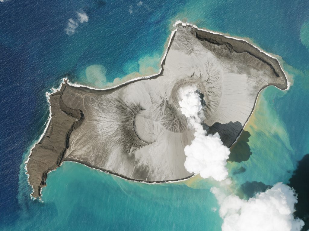
In late December, the island now named Hunga-Tonga Hunga-Ha’apai began to erupt from a new volcanic vent. Dan Slayback, a research scientist at NASA’s Goddard Space Flight Center in Maryland, has studied this island since its formation. “[The eruption] destroyed a large section of the 120-meter tall tephra cone left by the last eruption, and completely filled its crater lake with new material,” Slayback says, based on analysis of Planet and other satellite data. The change in the island’s appearance in only a matter of days is striking.
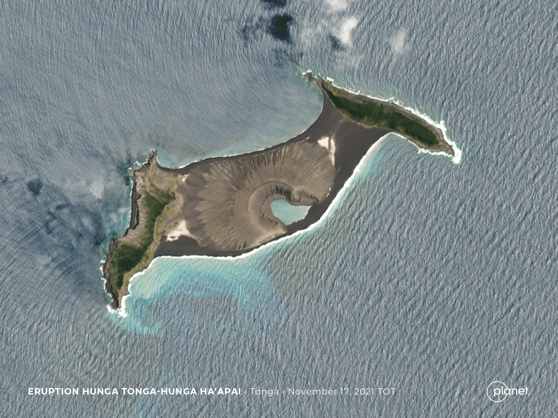
“Planet’s PlanetScope imagery captured the first clear view of the new island structure on 2 January 2022,” Slayback notes. Comparing PlanetScope imagery from mid-December, before the most recent eruption began, the surface area of the island appears to have expanded by nearly 45% due to ashfall. The volcano seems to have quieted down for now, letting off only steam as heat from it causes the lake inside its caldera to boil away. Through NASA’s Rapid Response and Novel Research in Earth Science program, Slayback and his team are continuing their study of Hunga-Tonga Hunga-Ha’apai. “We are now working to quantify the volume of ejected material using satellite observations, such as those available from Planet’s SkySat constellation.” Stereo observations from SkySat can be used to create digital elevation models, providing a three dimensional view of landscapes and their change over time.
If you are a researcher whose work is funded by NASA, the National Science Foundation, or any other federal civilian agency, you can access PlanetScope data for science use through NASA’s Commercial SmallSat Data Acquisition Program.


)