Planet Releases ArcGIS Add-In & QGIS Plugin V2.0
At Planet, we’re committed to reducing the friction of using satellite imagery so our users can gain the greatest value from our data. We do this by partnering with leading GIS-providers and delivering the necessary tools and software needed to derive insights from our data. We’re excited to announce the release of the new and improved Planet ArcGIS Add-In & Planet QGIS Plugin V2.0. The new integration products are designed to make it easier for GIS users to discover and apply imagery in their preferred mapping and analysis tools, enriching their applications and projects with more frequent satellite imagery.
The ArcGIS Add-In & QGIS Plugin V1.0 were released in December 2019 and enabled customers to search for, preview, and download Planet imagery & Basemaps directly within ArcGIS Pro and QGIS desktop. The update to 2.0 both strengthens these existing features and adds new capabilities to augment users’ imagery workflows in their GIS.
More search options to find the imagery your application needs.
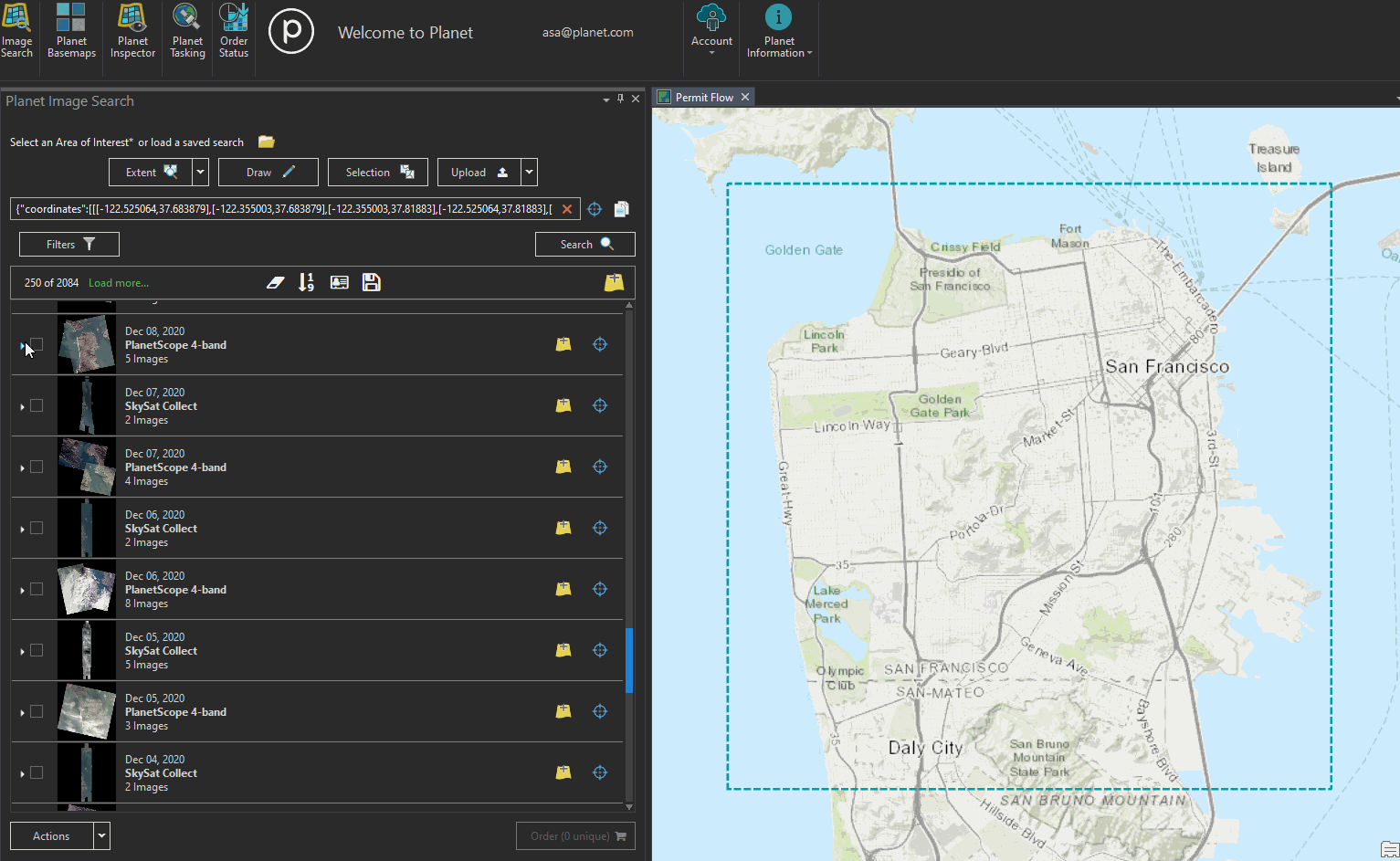
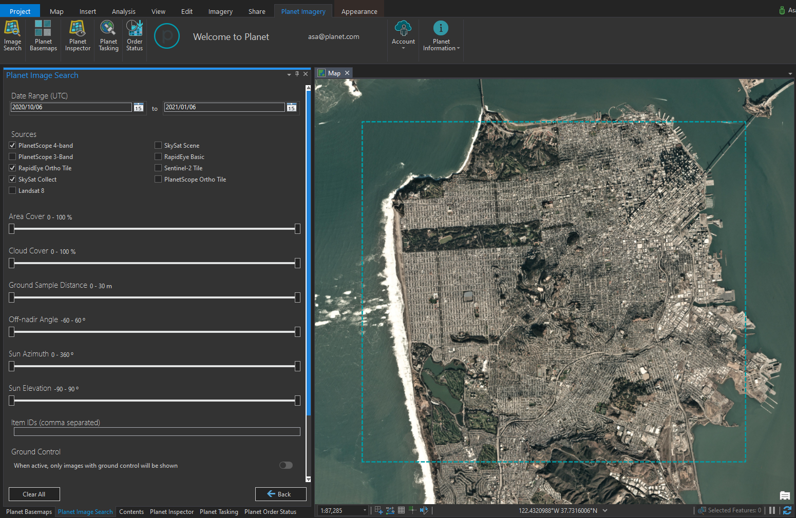
The Imagery Search Panel in ArcGIS & QGIS has new features and a new design. Users now have: more options to define their areas of interest, more imagery filters and a better designed filters page, the ability to view and customize metadata display in their search results, plus the ability to save their search within their GIS and access their saved searches across the Planet platform.
Experience the ability to view and customize metadata display in ArcGIS Add-in 2.0.
Find improved search options and imagery filters in ArcGIS Add-in 2.0.
More Basemaps visualization and download options to make the most of your Basemap subscriptions.
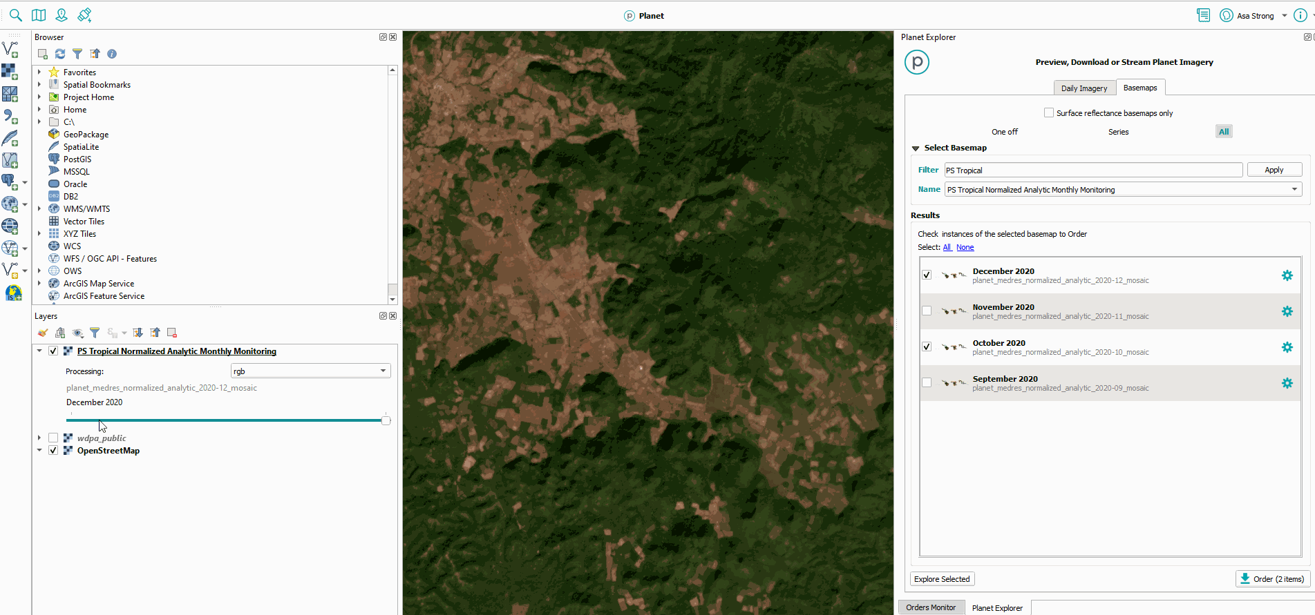
Unlike your typical GIS basemap, Planet Basemaps can be updated on a regular cadence and viewed with multispectral data, like near-infrared for Planet’s Surface Reflectance (SR) Basemaps.
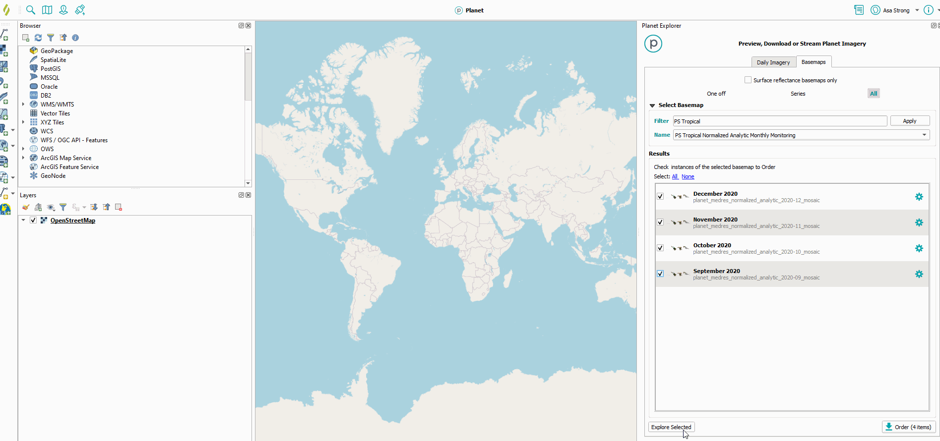
In Planet’s ArcGIS Add-In & QGIS Plugin 2.0 users with a Basemaps subscription can visualize their basemaps as a time-series and, for SR Basemaps, view them in false color using one of six visualization indices, like color infrared. Users can also now bulk download Basemap quads for a single Basemap or across a time-series using the Planet Basemaps Panel.
Use QGIS to perform advanced geospatial analytics on top of Planet data.
The Planet Basemaps Panel in QGIS now allows bulk download of Basemap quads.
Pro Tip: The new Planet Inspector Panel enables you to identify the contributing imagery scene on any Planet Basemap so that you determine when any pixel on a Basemap was collected and other information about the source image.
Task for High-Resolution Imagery within your GIS workflows
Tasking customers will also be able to task for high-resolution SkySat imagery directly within their GIS, enabling analysts to take advantage of the premier mapping capabilities of GIS software and pinpoint the precise location they’d like to examine with high-resolution imagery.
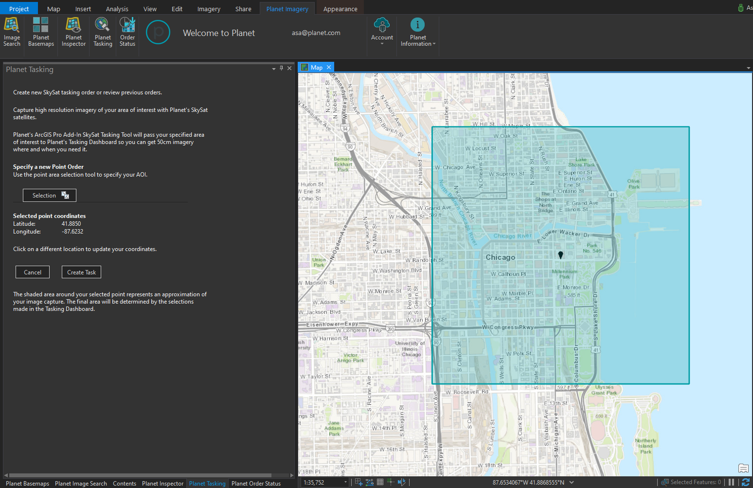
Easily define your AOI for high res tasking directly within your GIS
There are even more improvements and features waiting to be utilized in this release. To get started integrating Planet into your GIS workflows today, learn more at Planet’s Developer Center or download the integrations directly from the QGIS Plugins Repository and the ArcGIS Marketplace.


)