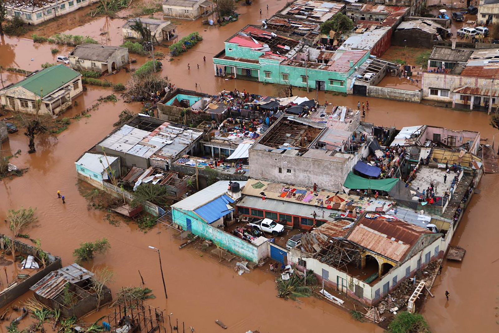
In January 2003, Tropical Cyclone Delfina dropped heavy rains over Malawi and Mozambique, causing devastating flooding. The floods lasted 47 days, killing 23 people and displacing some 400,000. More than a decade later, in January 2015, heavy rains swept through the two countries again, producing flooding in many of the same areas, killing nearly 300 people, and displacing just over 300,000.
These weren’t isolated events. The region experienced at least four other serious floods in the years between. But during that time, despite the relentless deluges, the total population living in flood zones grew. According to a new flood mapping tool called the Global Flood Database, between 2000 and 2015, the population exposed to flooding in Malawi and Mozambique increased by 150 to 250 percent.
It’s part of a concerning trend that’s occurring around the world. In a study published in the journal Nature on Wednesday, the architects behind the Global Flood Database found that during that same time period, the proportion of the global population exposed to flooding increased by 20 to 24 percent.
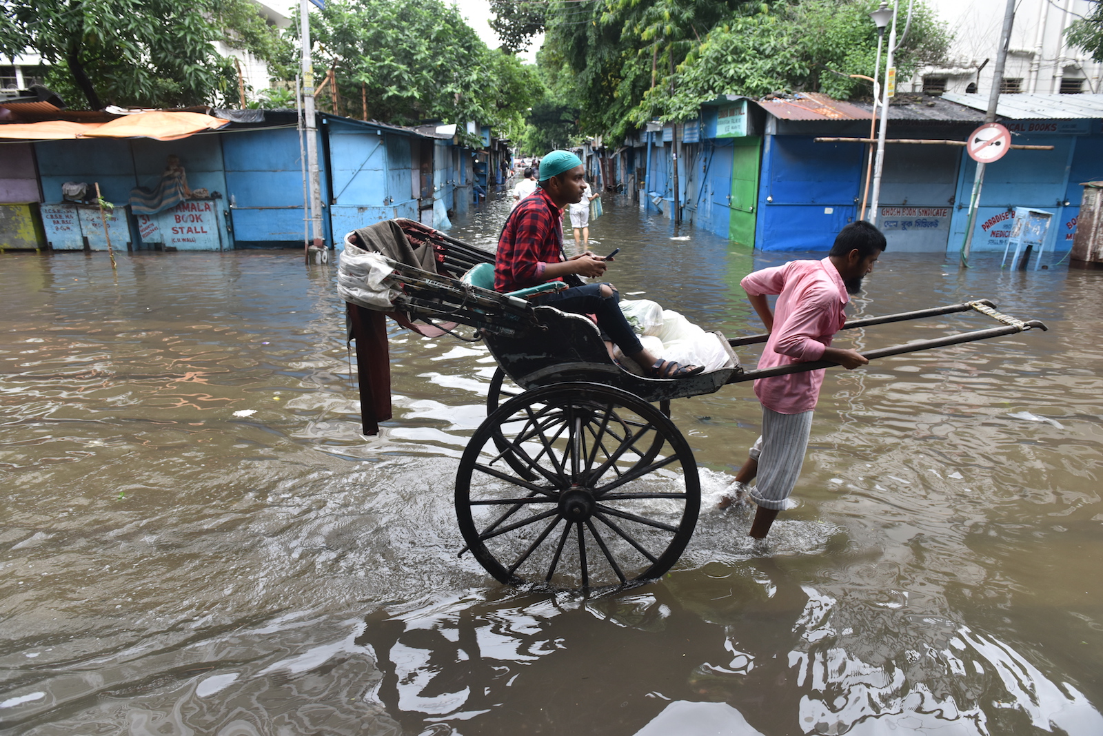
The study does not investigate the drivers of the trend, but there are a few possible explanations. Floodplains are expanding into new areas with dense populations due to sea-level rise and land-use change, but the researchers also think people are building at an accelerated pace in flood-prone areas. Beth Tellman, a geographer at the University of Arizona and the lead author of the paper, said that in many places, the cheapest land available to build a home is on the informal land market, in areas that are not zoned for formal development due to their high risk for environmental hazards. “That’s what we think is happening in some of the places that we’ve mapped,” she said, naming Dhaka, Bangladesh, and Guwahati, India as two examples.
Tellman and her coauthors are the first to do a global assessment of populations exposed to severe floods using observational data from more than 900 real events. Past studies have used models to assess flood damage and population exposure, but models can’t get a very accurate measure of where water actually goes during a flood. “If you think about how quickly humans are changing the surface of the Earth,” said Tellman, “we build levees. We expand cities. We do all of these things that change where water might flow.”
By comparing satellite images of flood events with images of permanent surface waters, they were able to map how far the flooding actually stretched into neighborhoods down to a resolution of 250 meters — about the size of two football fields. Then, by pulling global population data for 2000 and 2015, they calculated how much populations changed in affected areas during that period. The observational approach also enabled them to incorporate events that models can’t predict, like dam breaks.
Interestingly, they found that areas that flooded due to the collapse of dams or levees generally experienced the most growth over the study period. A dam break in Bihar, India, in 2008 killed 2,400 people and affected more than 3 million. According to the study, the population living in the area exposed to that flood grew by 194 percent between 2000 and 2015. Tellman said this might have been due to the “levee effect,” explaining that development often flourishes near dams and levees because they make people feel safe. “But if that infrastructure ever breaks, the consequences are really devastating,” she said.
One of the shortcomings of the satellite images, however, is that they do not render urban areas very well, meaning the analysis lacks information about flood impacts in cities. Tellman said that means there are several countries with high urbanization rates, like Cambodia and Namibia, whose flood risks are probably severely underrepresented by the study. In total, there were more than 2,000 known flooding events that the satellites did not pick up because of cloud cover, complex terrain, and other challenges.
Oliver Wang, the chief research officer at flood modeling company Fathom, told the Washington Post that with so much missing data, it was hard to trust the study’s conclusions. He said there have been advances in satellites and other technologies that have made better data available. But Sandra Knight, a senior research engineer at the University of Maryland told the Post that she thought the study’s maps could be useful in the United States. “Our current regulations are based on historical data that’s no longer accurate,” she said.
According to the study, the U.S. has not followed the global trend — the researchers found that the proportion of the population exposed to floods here actually decreased slightly during the study period. But they also estimated future flood exposure using models that project climate impacts and future growth. While these models are rife with uncertainty, the researchers found that the exposed population in the U.S. is likely to increase in the next decade.
For Tellman, these are risks that can be managed, whether through better land-use and zoning policies that discourage development in flood-prone areas, through the development of public housing and affordable housing options that prevent people from being pushed into informal settlements, and through the development of early warning and evacuation systems. She said the dam breaks documented by the study also underscore the need to invest in our infrastructure. A recent assessment of dams in the United States found that as of 2019, there were more than 15,000 dams classified as high hazard, meaning they could cause loss of life if they failed.
“We can’t control how much water falls, necessarily, although maybe we can by emitting less greenhouse gases,” said Tellman. “But we can definitely control who is in harm’s way and whose livelihoods or lives will or won’t be destroyed by that water.”